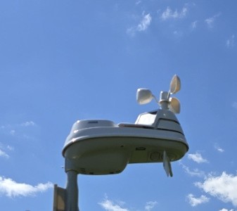
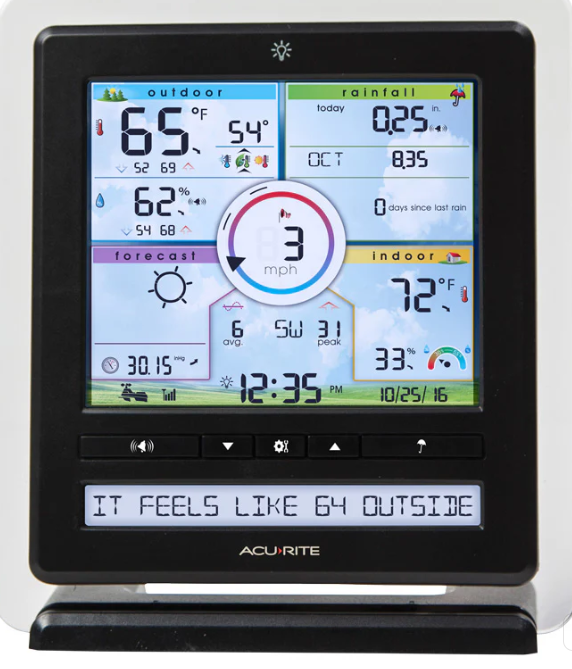
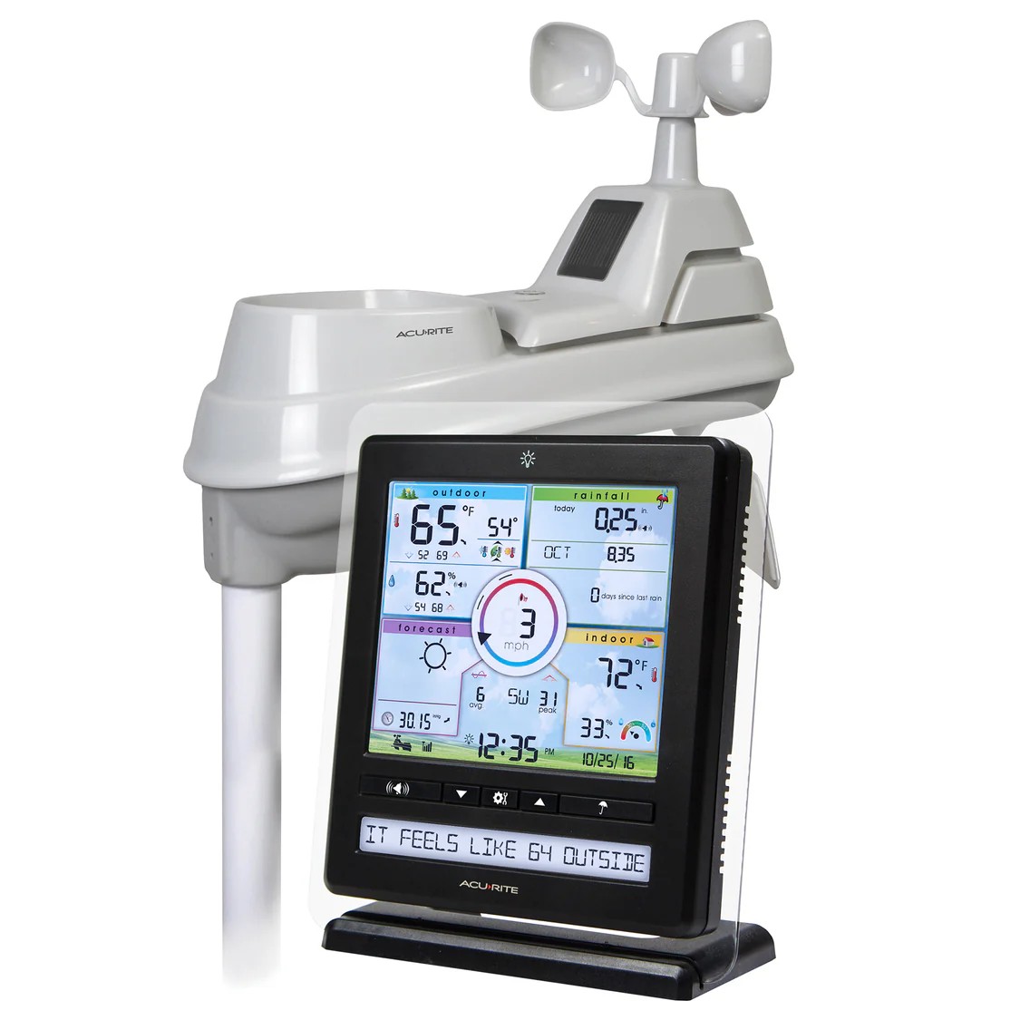
AcuRite Pro Weather Station with 5-in-1 Sensor, PC Connect, Wind Speed,
and Rain Gauge
|
Equipment overview:
Real-Time Weather Conditions: Receive readings for indoor and outdoor
temperature and humidity, wind speed and direction, barometric pressure,
and rainfall
Allows you to view data and set up notifications from the convenience of
your phone, whether you're home or away
Illuminated LCD Display: Easy-to-read display with backlight and
auto-dim feature
Easily connect your indoor weather station display to your PC to access
remote monitoring via the My AcuRite app and Weather Underground and to
share your data with more than 250,000 personal weather stations across
the globe
Comprehensive Weather Information with Weather Ticker: Displays
barometric pressure with trend arrow, heat index, dew point, and feels
like temperature
Forecasting Technology: Provides a hyperlocal, personalized weather
forecast 12 hours from your current conditions
Two solar panels power the internal fan to maximize ambient temperature
accuracy at all hours of the day (standard 5-in-1 includes only one
solar panel)
Durable, all-weather construction.
|
AcuRite Pro Weather Station with 5-in-1 Sensor, PC Connect, Wind Speed,
|
|
|
|
|
| |
|

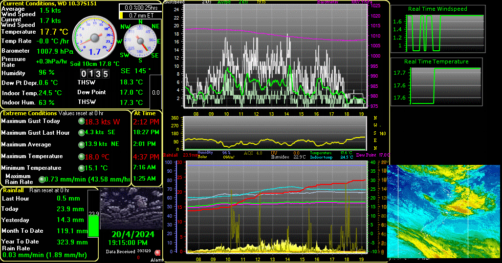 |
Weather Display is the software to get the most from your weather station. Not only does it support a huge range of stations from all the major manufacturers but it's also stacked with features and options. These include real time, auto scale and graph history graphing, FTP of the weather data to your web page, pager and email notifications of extreme conditions, web download, Metar/ Synop emails, averages/extreme/climate/NOAA reports, web cam upload, grouped file uploads, FTP downloads, decoded metar download's, APRS output (internet and direct com port as well) ,WAP, direct web cam capture, animated web cam images, weatherdials, weather voice, weather answer phone, use of Dallas 1 wire sensors (such as lightning counter, solar sensor, barometer sensor and extra temperature/humidity sensors with any weather station), use a Labjack to add extra temperature or humidity sensor to your existing weather station (USB)... and lots more!
For more information click the below link
|
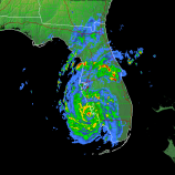
Radar
 |
GRLevel3 is a Windows viewer for live NEXRAD Level III data from the NWS Radar Product Central Collection Dissemination Service. See severe thunderstorm and tornado warnings along with details of Nexrad-identified threats
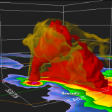
GR2Analyst is an advanced Nexrad Level II analysis application. It features a high quality volumetric display and several high resolution reflectivity-derived graphical products in addition to the standard Level II data products.
For more information click on the below image

|
|
|
|
Southeastern Kentucky Weather Web Cam
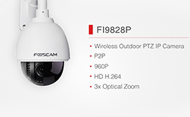 |
Foscam f19828p
(note this is our main webcam)
Wireless, Outdoor, Pan/Tilt Network Camera with 2-Way Audio
• 802.11b/g Wireless Communication
• This model was designed and is used for outdoor operation
• CCD Sensor for Enhanced Image Expression
• PTZ Control Camera Remotely
|